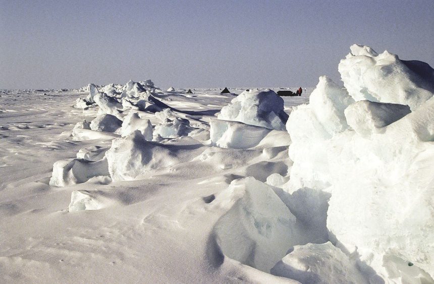
The Arctic Ocean’s winter freeze has started slowly again in several regions, as pulses of unusually warm air and water that retained summer heat delayed the formation of new sea ice. Satellite records show open water persisting later into autumn along parts of the Siberian and North American coasts, with young, thin ice forming only once temperatures finally fell. The timing of freeze-up matters because ice that forms late has less time to thicken before spring, leaving it more vulnerable to melting early the following summer. Thin first-year ice also moves faster in wind and currents, which changes conditions for wildlife that hunt and rest on it, and for northern communities whose travel routes depend on stable ice. Scientists tracking the season combine satellite imagery with buoy measurements of ice thickness, snow depth and ocean temperature. Those observations show a system responding to long-term warming in uneven ways, with some basins freezing close to schedule while others lag by several weeks in the same year.
What the Evidence Shows
Researchers caution against reading too much into a single season, since weather patterns can speed or slow the freeze dramatically from one year to the next. The longer record, however, shows a clear shift toward later freeze-ups and earlier break-ups across much of the Arctic, shortening the season in which thick ice can build. Snow falling on young ice complicates the picture further, because a deep snow layer can insulate ice from cold air while also weighing it down and flooding its surface. Field teams working from icebreakers and coastal stations are measuring those interactions directly, hoping to improve the models used for seasonal forecasts. Better forecasts would help shipping planners, wildlife managers and Indigenous communities anticipate conditions months ahead. The Arctic’s late freeze is also a reminder that the region warms several times faster than the global average, so changes that appear gradual in annual statistics can arrive abruptly in particular places, reshaping coastlines, ecosystems and travel within a single generation of residents. Reporting and analysis from sources such as NASA track the same developments, and specialists following late-forming winter sea ice in the Arctic say the direction is now consistent across independent lines of evidence.
The Wider Context
Funding bodies are watching late-forming winter sea ice in the Arctic closely because the work sits at the junction of basic curiosity and practical return. Grant panels increasingly ask for a path from discovery to application, while researchers push back that the most valuable uses of fundamental science are rarely the ones written into the original proposal. The tension is productive when both sides stay honest about timescales.
What Happens Next
The long view on late-forming winter sea ice in the Arctic is that fields advance by accumulation rather than by single announcements. This result adds a solid, checkable piece to a structure many teams are building, and its authors have shared their data so the piece can be tested from every side. That is how the picture eventually becomes reliable enough to act on. You can follow related developments in our coverage of science.
It is also worth remembering how quickly the picture in this area has changed before. Positions that looked settled a few years ago have been revised as new data arrived, and the same humility is appropriate now. The strongest coverage of this subject, and the most useful advice, tends to come from sources that update their views openly when the facts move, rather than defending an earlier position long after it has stopped fitting the evidence available.